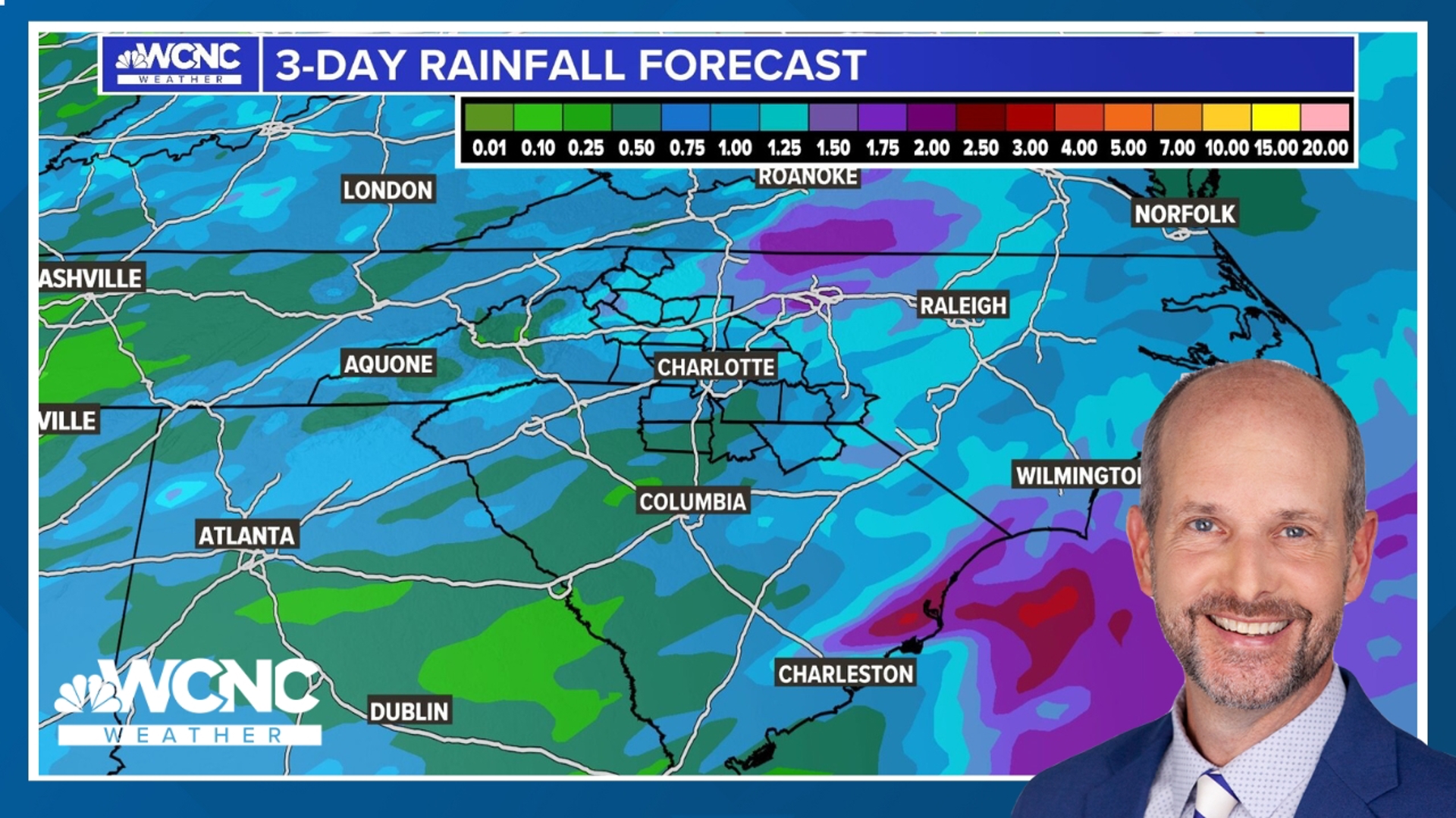
CHARLOTTE, N.C. — Heavy rain ongoing into Thursday will keep the flash flooding threat active in the Carolinas through the end of the week with some areas expecting up to 8 total inches of rain by the weekend.
Expect cloudy skies across the area with scattered showers and a few thunderstorms. Look for areas of fog this morning. High temperatures will be in the mid-70s, with areas east and southeast in the upper 70s. Lows tonight will be in the mid-60s.
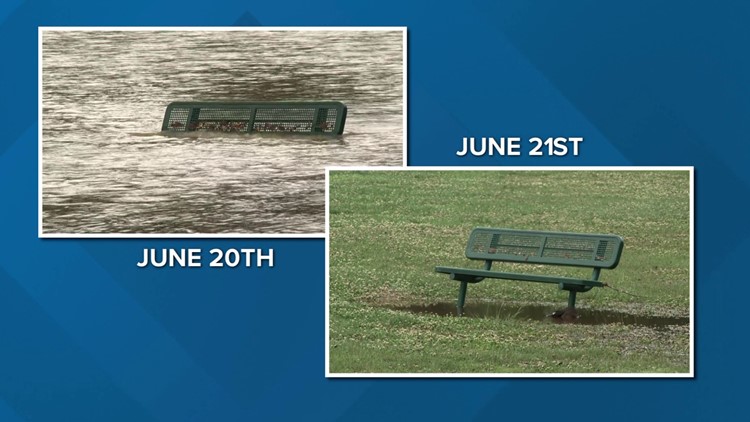
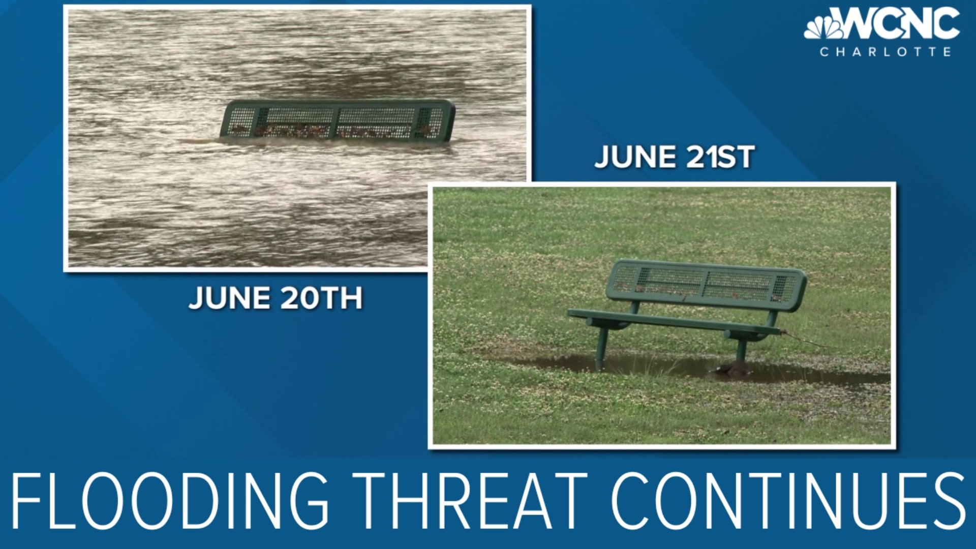
WCNC Charlotte's weather team has said everyone in the Charlotte area, including the mountains and foothills of western North Carolina, should be Weather Aware for the next few days. Crews in Kannapolis rescued 30 people when floodwaters trapped them in their homes Tuesday.
Futurecast rainfall projections
Boone: 2.18"
Charlotte: 0.96"
Chester: 1.2"
Concord: 0.96"
Gastonia: 1.15"
Hickory: 1.5"
Lancaster 1.3"
Rockingham: 1.4"
A flood watch is in effect for most of the Charlotte area through Thursday due to the heavy rain that's expected this week. Counties under the flood watch include Alexander, Ashe, Avery, Burke, Cabarrus, Caldwell, Gaston, Iredell, Lincoln, Mecklenburg, Rowan and Watauga.
The rain is expected to continue Thursday with periods of heavy rain throughout the day. WCNC Charlotte forecaster Larry Sprinkle said downpours are expected to stretch all the way from Greenville, South Carolina, to north of Charlotte and into the high country.
Thursday morning will pretty much be a washout but things should start to break up by the time we get to Friday.
Excessive rainfall outlook
Chief meteorologist Brad Panovich said the Carolinas are under what's known as the excessive rainfall outlook, meaning we're at risk for flash flooding. The entire Charlotte area will be at medium risk for flash flooding through Thursday before it goes down Friday.
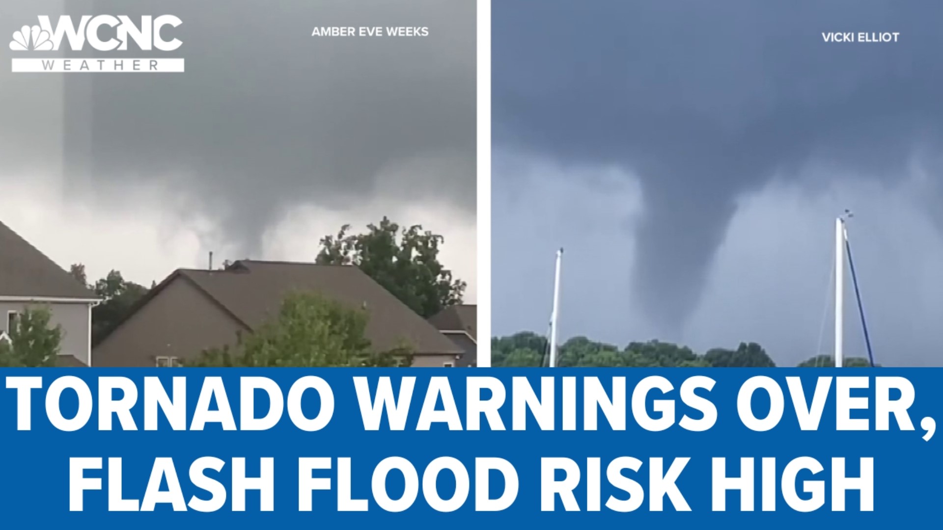
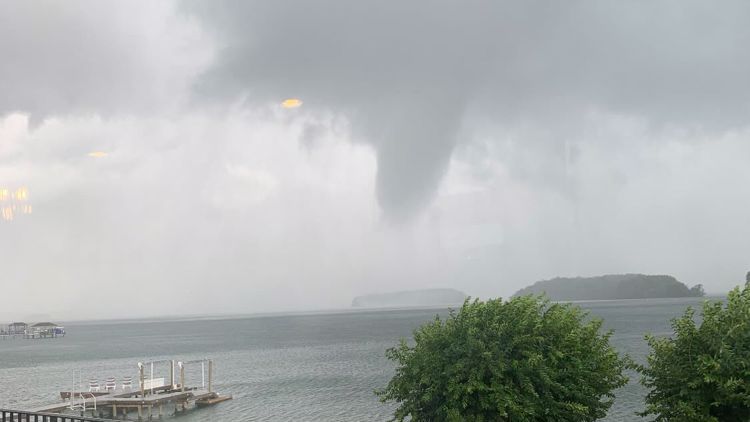
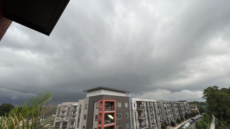
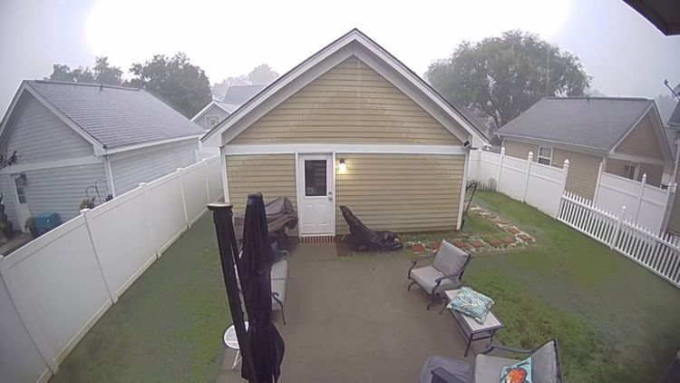
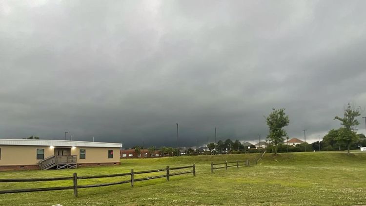
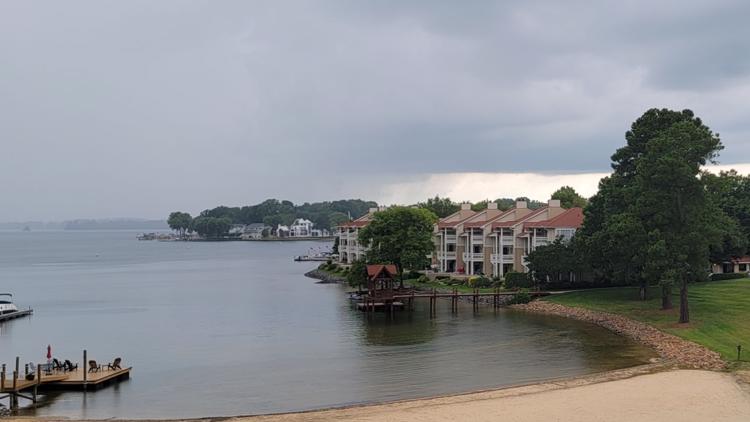
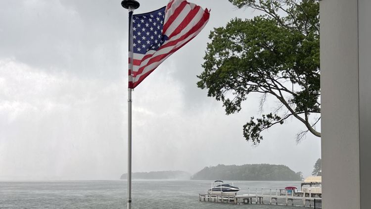
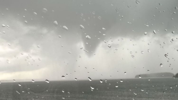
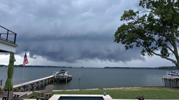
Your photos of severe weather across the greater Charlotte area


There will be some breaks in the rain, but Panovich wants to make it clear that we're in for a wet, miserable week. Don't let a few dry hours fool you into thinking we're in the clear.
"This setup is pretty nasty for rainfall," Panovich explained. "We could see just wave after wave of rain this week."
If you have any outdoor plans this week, you should be Weather Aware, knowing there is a chance of flash flooding and strong storms.
"That is going to be a huge risk this week," Panovich said. "And it could be one of those things where it builds over time. Plus the rain on Wednesday could really lead to some excessive rainfall that eventually could cause creeks or streams to rise real quickly."
Wake Up Charlotte To Go is a daily news and weather podcast you can listen to so you can start your day with the team at Wake Up Charlotte.
SUBSCRIBE: Apple Podcasts || Spotify || Stitcher || TuneIn || Google Podcasts
All of WCNC Charlotte's podcasts are free and available for both streaming and download. You can listen now on Android, iPhone, Amazon, and other internet-connected devices. Join us from North Carolina, South Carolina, or on the go anywhere.