CHARLOTTE, N.C. —
Excessive Rainfall:
Northeast Rainfall:
Flash flooding could be extensive and even historic for the Mid-Atlantic to the Northeast United States. The most intense rain looks to be from Eastern Pennsylvania through New York. A fancy weather term, QPF (Quantitative Precipitation Forecast) is pointing towards a range of 3-8" of rain. Most will be in the 2-5" range but some areas will see consistent heavy rain for several hours and this is where the danger lies.
Flash Flood Watches are painted across Ida's path and concern grows by Wednesday afternoon into the evening. A rare extensive excessive rainfall tag is trapped from the area that could have devastating flooding from this event.

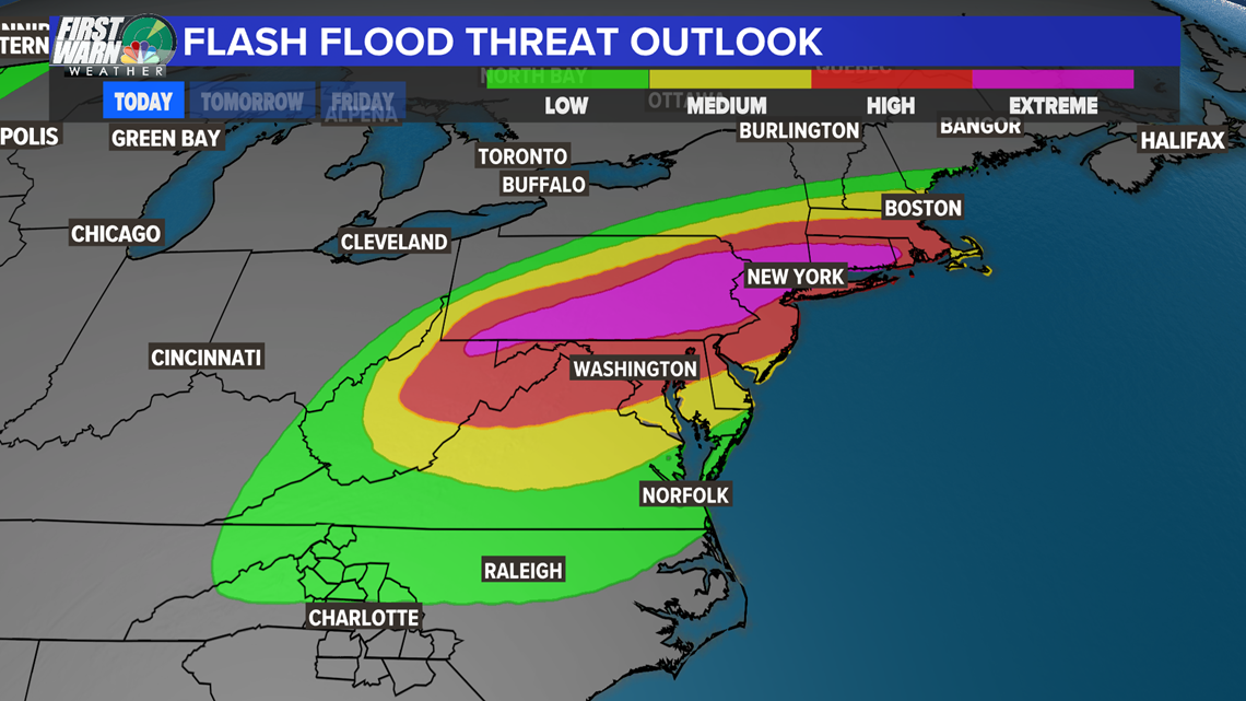
Eastern Pennsylvania, Northern New Jersey, Southern New York and Southern Connecticut got a lot of rain from Henri and have not completely dried out.
This will be a major story.
The North Carolina Mountains Rainfall:

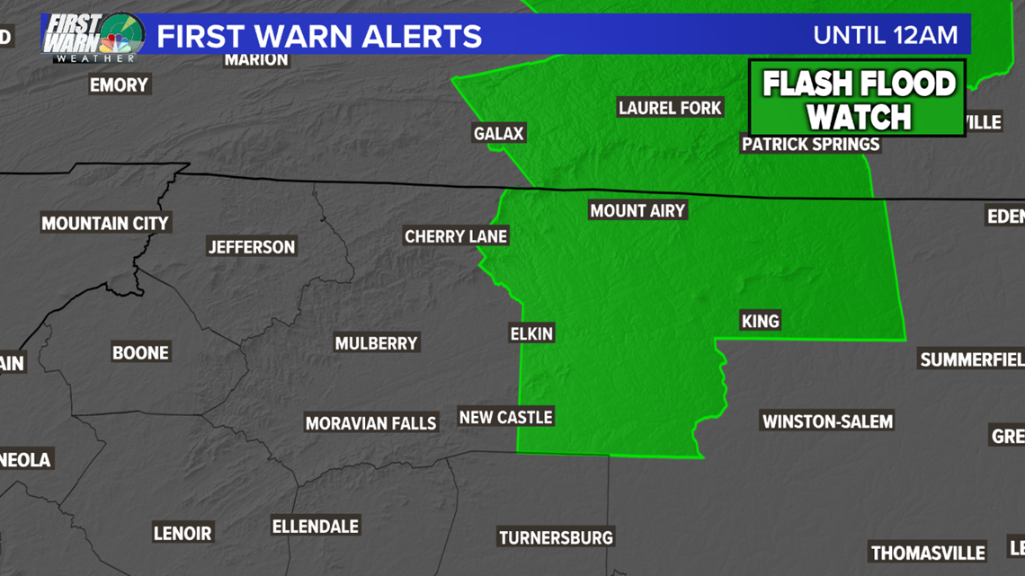
Scattered showers and storms from the remnants of the storm will still linger Wednesday afternoon. However, significant or widespread rainfall is not expected. The Flash Flood Watch for Watauga, Asha, and Wilkes counties has been cancelled.
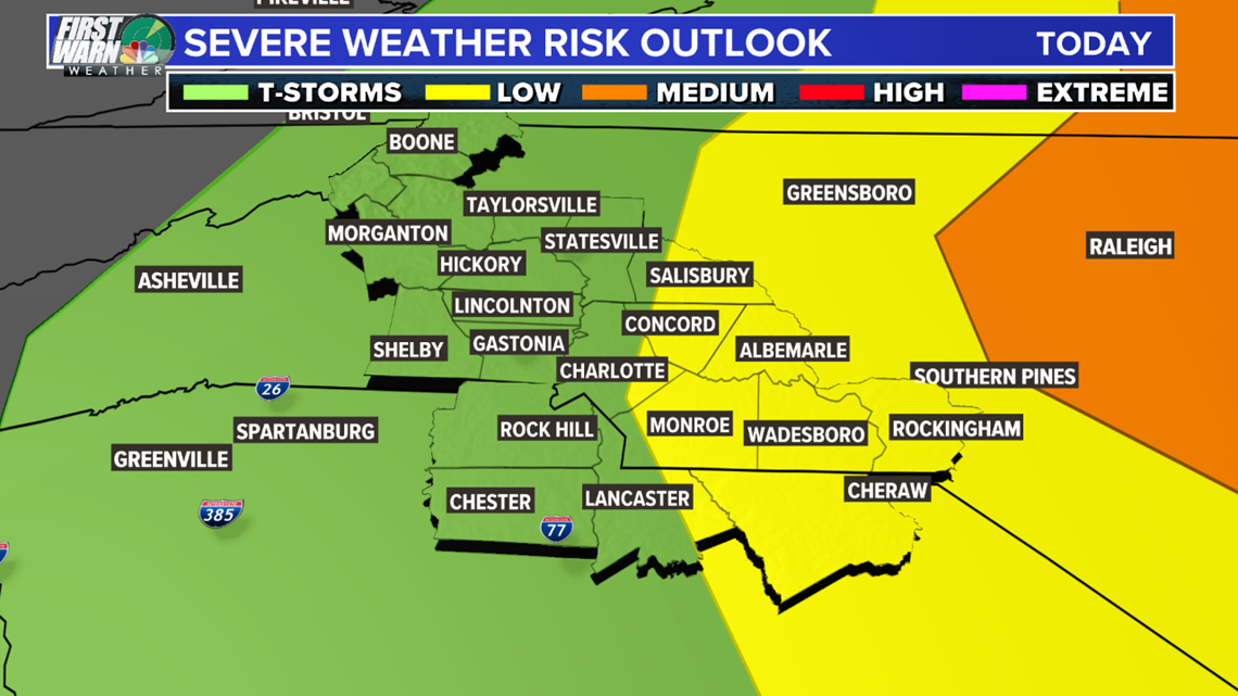
Severe Potential:
Carolinas:
The severe potential will come in the last line of possible storms this afternoon. The worst of the weather looks to be north and east of our area, since that will be closest to the center of Ida where there is more shear, which leads to more tornadoes and stronger thunderstorms.

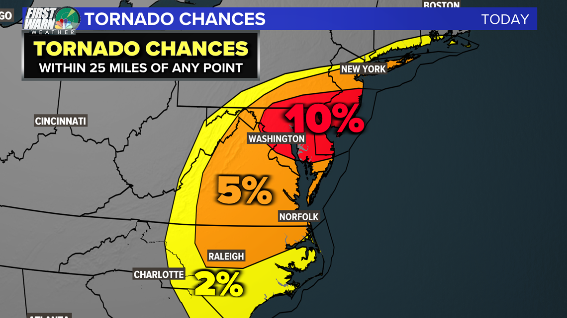
Tornado Threat:
The worst of the severe weather today will be under Ida as it moved northeast. There is a 10% bullseye in Maryland, Delaware and New Jersey. For example, we were under a 10% chance for tornadoes during Tropical Storm Fred in the Carolinas, and the Greenville-Spartanburg National Weather Service issued 37 tornado warnings.
There is still a better threat around Raleigh and even east of Charlotte in the WCNC viewing area has a slight chance for a rotating storm.
In summary, Ida's last breath looks to be substantial with the threat of dangerous flash flooding, strong storms and tornadoes.

Get the latest look at radar here:
🌩️ If you like weather, join Brad Panovich and the WCNC Charlotte First Warn Weather Team on their YouTube channel, Weather IQ. 🎥