
LATEST:
Isaias made landfall as a hurricane Monday night around 11:10 pm, near Ocean Isle Beach in North Carolina. Winds at that time were sustained at 85 mph.
According to the National Hurricane Center, by Tuesday at 8 p.m. the center of Isaias was moving through the New England states.
Besides storm surge and the high wind threat, Isaias was expected to produce very heavy rainfall along the I-95 corridor Tuesday. Part of that area was in a high-risk area for life-threatening flash flooding.
FORECAST:
Isaias was once again named a hurricane Monday night after re-strengthening. Previously, Isaias had been struggling to remain organized as wind shear had been breaking up the storm and dry air as well.
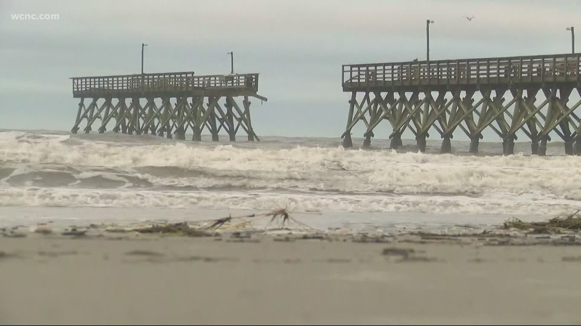
Chief Meteorologist Brad Panovich said the Myrtle Beach area has seen high water and flooding due to Isaias, as well as storm surge in Ocean Isle Beach, Holden Beach and other beaches on the North Carolina coast.
Isaias was a Category 1 storm when it made landfall in North Carolina.
"If this had three more hours over water, we would've seriously had a Category 2 or 3 storm," Panovich said.
The National Weather Service said the highest winds are expected across the Coastal Plain overnight into Tuesday.
As the system moves up I-95, Panovich said we could see stronger winds develop along the backside of Isaias.
IMPACTS:

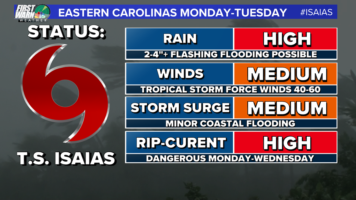
Our best news here is the speed at which this storm will move through the Carolinas. This limits all of the above expect for dangerous rip currents which are active even for this weekend.
RELATED: ‘Now is the time to prepare,’ Gov. Cooper declares a state of emergency ahead of Hurricane Isaias
YOUR LOCAL IMPACTS:
For the Charlotte area back to Hickory and Boone we might not even know it's out there. We will see some clouds and breezy conditions, at times. The bigger impacts for rain will come from a slow-moving upper low and trough that will be hanging over the region through most of next week. Still, heavy rain and storms are possible through your late Monday and Tuesday morning associated with the outer bands working with that low mentioned above to promote scattered to widespread rain.
Stay tuned for later updates and follow up on Social Media for more updates on the storm as it gets closer to the Carolinas. Track forecast updates are coming out every day at 5AM, 11AM, 5PM, and 11PM until the storm is gone.