
CHARLOTTE, N.C. — This is a severe weather live blog from WCNC Charlotte:
10:35 p.m.: The severe threat is gone for the area, but the damage remains from high winds and hail.
Emergency crews were stationed at Great Falls Fire Department after a funnel cloud was reported in the area, but it's too early to tell how much damage was caused in that area.
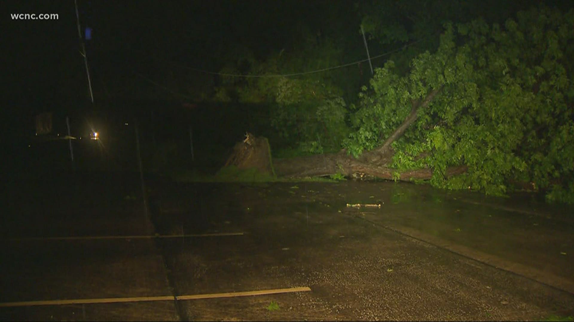
Golf-ball sized pieces of hail were reported in the area along with high winds leading to downed trees, roads blocked and downed power lines. Crews across Chester County were out responding in the storm's aftermath.


“The biggest challenge at night is not seeing some of the dangers like live power lines or any other hazards that are out there," Capt. Mike Erhmantraut with the Richburg Fire Department said. "It's just using a lot more lights and establishing a safety person to look out for those hazards.”
The Chester County coroner confirmed one person died after being struck by lightning.
So far, no other injuries have been reported related to the severe weather.
9:45: The Charlotte area is deemed "all clear from severe" but a few showers or isolated storms could still be moving through the area.
7:30 p.m.: There are no active tornado warnings as of 7:30 p.m.
The thunderstorm previously warned for a possible tornado, continues to the east, where it has prompted a Severe Thunderstorm Warning for parts of Chesterfield, Kershaw, and Lancaster counties. The storm remains possible of producing damaging wind and hail.
Over the last hour as the storm moved east from the City of Chester towards the Catwaba River and eventually into Lancaster County, it dropped hail the size of golf balls. It also brought down some trees.
WCNC Charlotte is headed to the area to survey storm damage. We will have updates online and on-air throughout the evening, with a complete wrap-up tonight at 11 p.m.
7:15 p.m.: Early storm reports indicate the storm produced damaging hail, upward of 1.5" - 2" inch, and produced winds strong enough to topple trees.
If you have storm pictures or videos, you can text them to us at 704-329-3600. You can also reach us on Facebook and Twitter.
7:00 p.m.: The National Weather Service has extended the Tornado Warning into Lancaster County until 7:30 p.m.
Locations inside the extended warning include, but are not limited to, Heath Springs, Kershaw, and Westville.
At 7 p.m., the tornado was crossing out of Chester County over the Catawba River. The warning for Chester County continues until 7:15 p.m.
---
6:45 p.m.: WCNC viewers in Chester County, South Carolina are sharing pictures of golf ball size hail.
The National Weather Service confirmed 1.75" hail fell along Highway 9 east of Chester.
---
6:30 p.m.: The National Weather Service has issued a Tornado Warning for Chester County, South Carolina. Locations inside the warning include, but are not limited to, Richburg, Fort Lawn, Fishing Creek Reservior, and Great Falls
A tornado could be on the ground as it moves east at 55 mph.
Brad Panovich is seeing a radar signature that could indicate debris aloft on First Warn Doppler radar.
The warning continues until 7:15 p.m. If it were to be extended, it would continue into Lancaster County.
---
Original forecast story:
A low end risk for severe weather Tuesday night could producing strong-to-severe thunderstorms capable of damaging wind, hail, and an isolated tornado.
Starting around 7 p.m. and continuing through 10 p.m., the main line of thunderstorms is expected to push across Charlotte, Mecklenburg County, and the surrounding metro. Additional discrete, scattered thunderstorms outside of that timeperiod cannot be ruled out.
A Severe Thunderstorm Watch was in effect for our entire area through 11 p.m.
By 5 p.m., a few severe thunderstorms had already impacted upstate South Carolina ahead of their forecasted arrival in the Piedmont. The National Weather Service had issued localized Severe Thunderstorm Warnings for those storms because of their damaging wind and hail potential.
Chief Meteorologist Brad Panovich and the First Warn Storm team are tracking all evening.
"The good news is... this won't happening overnight while you're sleeping. The bad news, another round of severe weather. " Brad said. "I will caution: We are in the midst of severe weather season. April and May is our severe weather season."
Severe potential Tuesday evening

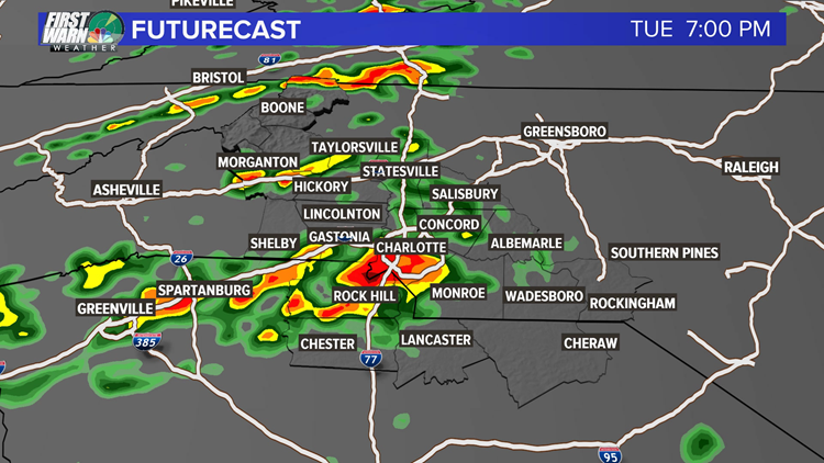

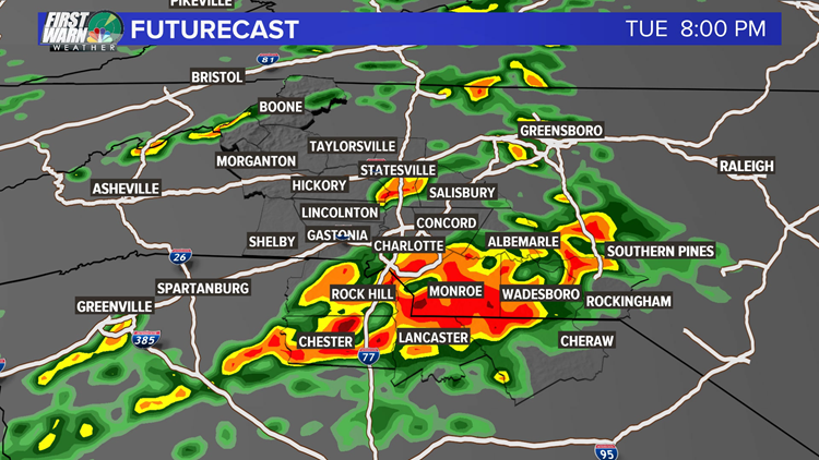

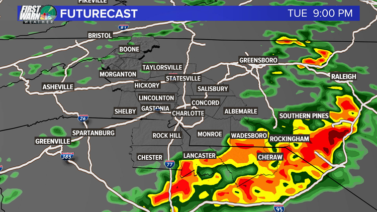

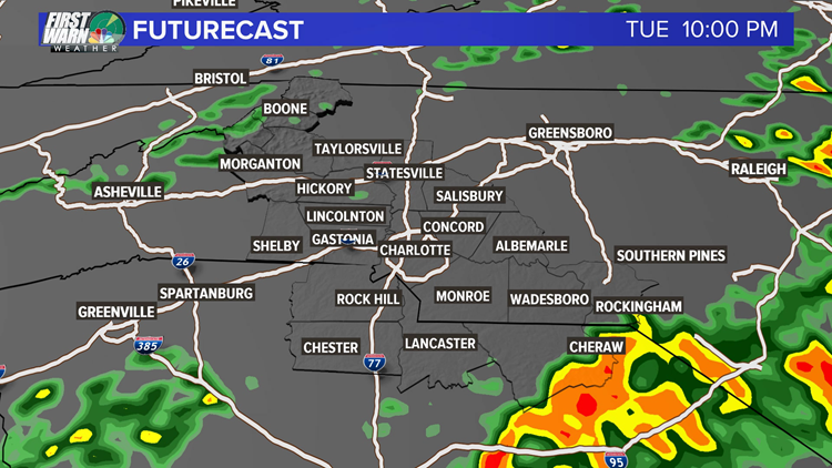

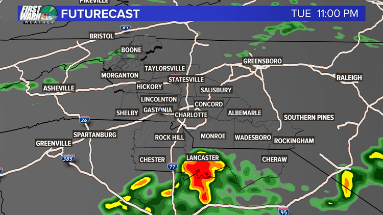
The First Warn Futurecast shows the potential location of storms over the coming hours. Brad cautions: Futurecast is a good tool to show the broader landscape, but "don't get locked in on any one location," he said. "The actual location of a storm could shift north or south at the end of the day."
A Severe Thunderstorm Watch means conditions are expected for severe thunderstorms over the coming hours. A Severe Thunderstorm Warning is issued when a thunderstorm capable of 60 mph winds and/or 0.75" inch hail was occuring or was imminent in the coming minutes.
Lightning is not a character of a Severe Thunderstorm Warning. Even a thunderstorm without a warning can produce dangerous lightning. Do not wait for a warning before seeking shelter from a thunderstorm. If you hear thunder, move inside immediately.
The First Warn Storm Team will have live coverage on-air, online, and on social media as the weather warrants.
More news: